Showing posts with label touring trips. Show all posts

Avala Tower in Serbia

    The Avala Tower is a 204.5 m tall telecommunication tower located on Avala mountain near Belgrade, Serbia. It was destroyed in NATO attack of Serbia on 29 April 1999. On 21 December 2006 the renovation of Avala Tower started and tower was officially opened at a ceremony attended by highest state officials on 21 April 2010. It is at present tallest structure in Serbia and the Balkan region. The more details about Avala Tower is explained in world tour guides below.
    The tower was designed by architects Ugljesa Bogdanovic, Slobodan Janjic and engineer Milan Krstic. Construction started on 14 October 1961 and was completed four years later in 1965. The tower weighed 4,000 tonnes. Between 102 m and 135 m there was an enclosed observation deck. It was the only tower in the world to have an equilateral triangle as its cross section, and one of very few towers not perched directly into the ground, but standing on its legs. The legs formed a tripod making it one of the small number of towers to be constructed in that manner.

    The tower was surmounted by an antenna which was at first used for black and white television transmission. In 1971 the antenna was replaced by a new one for color TV transmission. The project which was of high risk was finished without any worker injuries or deaths which were unusual for a project of its size.

    Avala Tower was destroyed on 29 April 1999 by NATO attack allegedly to put Radio Television of Serbia off the air. Radio Television Serbia broadcasting did not suffer as it was relying on a network of local TV stations which were obliged to relay its program throughout whole of Serbia. The tower was one of last buildings to be destroyed before end of NATO operation. A special bomb was used to destroy the tower. The blast was one of loudest explosions heard throughout Belgrade during NATO attack. Between date of its destruction and 11 September 2001 it was tallest building ever destroyed succeeding the Singer Building. As of 2001 it is third tallest building ever destroyed.

    In 2004 Radio Television Serbia commenced a series of fund-raising events in order to collect money to construct the building once again at the same place it was destroyed. In 2005, clearing of the site where the tower was destroyed began and on 21 December 2006 the construction of a new Avala Tower commenced. An agreement regarding its construction was signed by Dusan Basara director of construction sector of Ratko Mitrovic Company which will be in charge of the construction of the tower and general director of RTS Aleksandar Tijanic.

    Initially completion of new tower was expected in August 2008, but construction works were severely delayed. The opening date was pushed back to 29 April, the tenth anniversary of its destruction. Radio Television Serbia reported on 23 October 2009 that the tower has been completed.

    Many fund raising events have been held for collection of funds so a new tower can be constructed. One of first was a match between Serbian grand slam winning tennis players Ana Ivanovic and Novak Dokovic. All the proceeds went to Avala Tower fund. Ceca Raznatovic a Serbian folk singer held a concert on 15 June 2006 with all the proceeds going to Avala Tower fund. Radio Television Serbia ran commercials for donations to rebuild the tower. According to a December 2006 report when it was announced that construction of a new Avala Tower would commence that same month over €1 million was collected through fund-raising and donations.

Post Title

Avala Tower in Serbia


Post URL

https://guidice-galleries.blogspot.com/2010/09/avala-tower-in-serbia.html?m=0


Visit guidice galleries for Daily Updated Wedding Dresses Collection

Carcassonne in France

    Carcassonne is a fortified French town in the Aude department which is the prefecture in the former province of Languedoc. It is separated into the fortified Cite de Carcassonne and the more expansive lower city, the ville basse. The folk etymology involving a chatelaine named Carcas a ruse ending a siege and the joyous ringing of bells though memorialized in a neo Gothic sculpture of Mme. Carcas on a column near the Narbonne Gate is of modern invention. The fortress, which was thoroughly restored in 1853 by the theorist and architect Eugene Viollet-le-Duc was added to the UNESCO list of World Heritage Sites in 1997.

    CarcassonneCarcassonne became strategically identified when Romans fortified hilltop around 100 BC and eventually made it colonia of Julia Carsaco later Carcasum. The main part of lower courses of northern ramparts dates from Gallo Roman times. In 462 Romans officially ceded Septimania to Visigothic king Theodoric II who had held Carcassonne since 453 he built more fortifications at Carcassonne which was a frontier post on northern marches traces of them still stand. Theodoric is thought to have begun predecessor of basilica that is now dedicated to Saint Nazaire. In 508 Visigoths successfully foiled attacks by the Frankish king Clovis. Saracens from Barcelona took Carcassonne in 725 but King Pepin Short drove them away in 759-60 though he took most of south of France he was unable to penetrate impregnable fortress of Carcassonne.

    The medieval fiefdom county of Carcassonne controlled city and its environs. It was often united with County of Razes. The origins of Carcassonne as a county probably lie in local representatives of Visigoths but first count known by name is Bello of time of Charlemagne. Bello founded a dynasty Bellonids which would rule many honores in Septimania and Catalonia for three centuries. In 1067 Carcassonne became property of Raimond Bernard Trencavel viscount of Albi and Nimes through his marriage with Ermengard, sister of last count of Carcassonne. In following centuries Trencavel family allied in succession either with counts of Barcelona or of Toulouse. They built Chateau Comtal and Basilica of Saint Nazaire. In 1096 Pope Urban II blessed foundation stones of new cathedral a Catholic bastion against Cathars.

    Carcassonne became famous in its role in Albigensian Crusades when city was a stronghold of Occitan Cathars. In August 1209 crusading army of Simon de Montfort forced its citizens to surrender. After capturing Raymond-Roger de Trencavel imprisoning him and allowing him to die Montfort made himself new viscount. He added to fortifications. Carcassonne became a border citadel between France and the kingdom of Aragon.

    Carcassonne was struck from roster of official fortifications under Napoleon and Restoration, and fortified cite of Carcassonne fell into such disrepair that French government decided that it should be demolished. A decree to that effect that was made official in 1849 caused an uproar. The antiquary and mayor of Carcassonne Jean Pierre Cros Mayrevieille and writer Prosper Merimee first inspector of ancient monuments led a campaign to preserve the fortress as a historical monument. Later in the year the architect Eugene Viollet-le-Duc already at work restoring the Basilica of Saint-Nazaire was commissioned to renovate the place.

    In 1853 works began with west and southwest walling followed by towers of Porte Narbonnaise and principal entrance to cite. The fortifications were consolidated here and there but chief attention was paid to restoring roofing of towers and ramparts where Viollet-le-Duc ordered the destruction of structures that had encroached against the walls, some of them of considerable age. Viollet-le-Duc left copious notes and drawings at his death in 1879 when his pupil Paul Boeswillwald and later architect Nodet continued rehabilitation of Carcassonne.

    CarcassonneCarcassonneThe restoration was strongly criticized during Viollet-le-Ducs lifetime. Fresh from work in north of France he made error of using slates and restoring roofs as pointed cones where local practice was traditionally of tile roofing and low slopes in a snow free environment. Viollet-le-Ducs achievement at Carcassonne is agreed to be a work of genius though not of strictest authenticity. Fortification consists of a double ring of ramparts and 53 towers. Another bridge Pont Marengo crosses Canal du Midi and provides access to railway station. Lac de la Cavayere has been created as a recreational lake and is about five minutes from the city centre.

    The newer part of city on other side of Aude River manufactures shoes, rubber and textiles. It is also center of a major AOC wine growing region. A major part of its income comes from tourism connected to fortifications and from boat cruising on Canal du Midi. Carcassonne receives about 3 million visitors annually. In late 1990s Carcassonne airport started taking budget flights to and from European airports and by 2009 had regular flight connections with Bournemouth, Cork, Dublin, Edinburgh, Frankfurt-Hahn, Stansted, Liverpool, East Midlands and Charleroi.

Post Title

Carcassonne in France


Post URL

https://guidice-galleries.blogspot.com/2010/09/carcassonne-in-france.html?m=0


Visit guidice galleries for Daily Updated Wedding Dresses Collection

Zugspitze Mountain in Germany

    The Zugspitze is highest mountain in Germany at 2,962 metres above sea level. It is located on Austrian border beside the town of Grainau in district of Garmisch Partenkirchen in federal-state of Bavaria. On Austrian side lies the town of Ehrwald in district of Reutte, Tyrol. There is a cog railway leading from tourist resort of Garmisch-Partenkirchen to Zugspitzplatt from where a cable car runs to peak. There are also two cable cars that go to peak from the base of mountain one ascends from German side of mountain at lake Eibsee and other ascends from Austria near Ehrwald. The peak is regularly crowded with tourists. The details of Zugspitze are explained in world tour guides below.

    Zugspitze MountainFor those wishing to reach the summit under their own power, various hiking and ski trails can also be followed to the top. Hiking to the top from the base takes between one and two days, or a few hours for the very fit. Food and lodging is available on some trails. In winter the Zugspitze is a popular skiing and snowboarding destination, with several slopes on both sides. The Zugspitzplatt is Germany's highest ski resort, and thus normally has sufficient snow throughout the winter.
    The border between Germany and Austria goes right through the mountain. There used to be a border checkpoint at the summit. But since Germany and Austria are now both part of the Schengen zone, the border crossing is no longer staffed. The Zugspitze belongs to the Wetterstein range in the Northern Limestone Alps. It gets its name from the many avalanche passages on its steep north slopes. At the Zugspitzes summit is the Munchner Haus a mountain hut, a facility built by the German Alpine Club. For more than a hundred years, the summit has also had a weather station, which nowadays also gathers data for the Global Atmosphere Watch.

    Shortly after World War II the US military took over the Schneefernerhaus for the exclusive use of US military and civilian employees. Room rates, including meals, were US $ 1 per day. Ski lessons were available, taught by Austrians and Germans, at a cost of US $ 0.25 per hour. The first recorded ascent to the summit was accomplished by a team of land surveyors on the 27th of August, 1820. The team was led by Lieutenant Josef Naus who was accompanied by two men named Maier and G.Deutschl. However, local people had conquered the peak over 50 years earlier, according to a 1770 map discovered by the Alpenverein.

    On 7 January 1882 the first successful winter assault on Zugspitze was accomplished by F. Kilger, H. and J. Zametzer and H. Schwaiger. Climbing up Zugspitze can involve several routes. The large difference in elevation between Garmisch-Partenkirchen and summit is 2 200 m making the climb a challenge even for trained mountaineers. On German side from Garmisch-Partenkirchen climbers go either through Hollental or Reintal. The way through Reintal is easiest but also longest and takes 8 to 10 hours. This path goes through the Partnachklamm a scenic gorge then through Reintal up to Zugspitzplatt, a barren plateau from there up to the summit. Climbers can stay for night at two alpine huts Reintalangerhutte or Knorrhutte.

    Zugspitze MountainZugspitze Mountain
    The more popular but harder route is through Hollental. It starts at Hammersbach near Garmisch goes through Hollentalklamm a similar gorge up to Hollentalangerhutte where one can take a meal or stay for night. It then crosses Hollentalferner remnants of a small glacier. After that it traverses a wall with help of iron ladders and steps. Via ferrata equipment is recommended for that part. Over Irmerscharte it reaches the summit. This path will take 7 to 8 hours.

    From Austrian village of Ehrwald there are also two variants. One goes straight through the Western Flank, which is the shortest route overall, but rather hard. It includes via ferrata and there is a hut called Wiener Neustadter Hutte by Austrian Alpine Club. An easier path leads via Ehrwalder Alm across a small pass called Gatterl joining Reintal path at Knorrhutte. The Zugspitzes exact height was a matter of debate for quite a while. Given figures ranged from 2 960 m to 2 970 m but it is now generally accepted that peak is 2962 m above sea level as a result of a survey carried out by the Bavarian land survey office. The lounge at new cafe is named 2962 for this reason.

Post Title

Zugspitze Mountain in Germany


Post URL

https://guidice-galleries.blogspot.com/2010/08/zugspitze-mountain-in-germany.html?m=0


Visit guidice galleries for Daily Updated Wedding Dresses Collection

Megyeri Bridge

    The Megyeri Bridge previously known as Northern M0 Danube Bridge is a cable stayed bridge that spans River Danube between Buda and Pest respectively west and east sides of Budapest, capital of Hungary. It is an important section of M0 ringroad around Budapest. The details of Megyeri Bridge are explained in world tour guides below.

    Megyeri BridgeThe bridge cost 63 billion forints approximately US$ 300M to build and was officially opened on September 30, 2008 however National Transport Authority of Hungary has only issued temporary permits because of disagreement among suburban cities surrounding the bridge. A naming poll to determine new name of recently-built bridge caused controversy and received media attention when American comedians Stephen Colbert and Jon Stewart won. The total length of bridge is 1862m. Structurally it is composed of five parts. They are Left quayside inundation area bridge 148m, Main Danube-branch bridge cable stayed 590m with a span of 300m, Szentendre island inundation area bridge 559m, Szentendre Danube-branch bridge 332m and Right quayside inundation area bridge 218m.

    The Ministry of Economic Affairs and Transport of Hungary organized a public vote online to solicit possible names for new bridge. The three names with most votes as well as suggestions from local governments, cartographers, linguists and other experts were to be reviewed by government committee before a final name for bridge was chosen. New nominations were accepted until August 21, 2006, and voting ended on September 8, 2006, with Stephen Colbert winning with 93,163 votes, and Jon Stewart and Zrinyi close behind with 85,171 and 83,966 votes, respectively.

    On August 1, 2006 Reuters reported that top candidate according to the online poll was the Chuck Norris hid named for American action star Chuck Norris. On August 11, 2006 American satirist Stephen Colbert discussed story on his comedy program The Colbert Report instructing his viewers to visit polling website and vote for him instead of Norris. The next day the number of votes for him had grown 230 times and he now asked his viewers to follow a link from his own Colbert Nation website to avoid all that illegible Hungarian. Colberts site also indirectly offered techniques for stuffing the ballot box as users of their forums created several automated scripts to cast multiple votes for Colbert.

    Megyeri BridgeMegyeri Bridge
    On August 15, 2006 he repeated his call to be voted top of Hungarian poll and by August 22, 2006 Stephen Colbert hid was in first with 17 million votes about 14 million votes ahead of second-placed Zrinyi hid named after Croatian Hungarian national hero Miklos Zrinyi and about 7 million more than entire population of Hungary. The same day site announced a new round of voting which would require registration to participate and Colbert asked his viewers to call off dogs requesting on his website that fans stop using scripts to vote. Despite this Stephen Colbert hid remained in the top position on the website in the second round.

    On September 14, 2006 Andras Simonyi the ambassador of Hungary to the United States announced on The Colbert Report that Stephen Colbert had won the vote. Unfortunately for Colbert Ambassador Simonyi declared that under Hungarian law Colbert would have to be fluent in Hungarian and would have to be deceased in order to have the bridge named for him. However after saying the rules could most likely be bent he invited Colbert to visit Hungary and view the construction in person and gave him a Hungarian passport and a 10,000 HUF Bill with an approximate value of as the ambassador put it fifty dollars, fifty good US dollars. Colbert promptly tried to bribe him with said money.

Post Title

Megyeri Bridge


Post URL

https://guidice-galleries.blogspot.com/2010/08/megyeri-bridge.html?m=0


Visit guidice galleries for Daily Updated Wedding Dresses Collection

Kochi Castle in Japan

    Kochi Castle is a castle located in Kochi, Kochi Prefecture, Japan. Next to the Battle of Sekigahara in 1600 Kochi Castle was constructed in what was then the province of Tosa. It was built by Yamanouchi Kazutoyo who took control of the province after the Tokugawa victory. The castle was constructed as part of the move from Urado to the more defensible Otakasa area. The details of Kochi Castle are explained in world tour guides below.

    Kochi CastleThe construction of Kochi Castle was begun in 1601 and was completed in 1611. Much of original fortress burned down in 1727. It was reconstructed between 1729 and 1753 in original style. The castle underwent major restoration from 1948 to 1959. Though no battles were fought at castle it is remarkable because castle is the original structure and not a post war replica. It is also the only castle in Japan to retain both its original tenshu or keep and its palace. In fact, it is the only castle to have all the original buildings in the honmaru or innermost ring of defense, still standing.

    Two previous attempts were made to build castles on Otakasa Hill. Both failed. The first attempt was by Otakasa Matsuomaru sometime during the late Heian or Kamakura periods. The second was in 1588 by the conqueror of Shikoku Chosokabe Motochika. The area around the hill at this time was extremely swampy due to the influx of alluvial sediments from the Kagami River. Consequently, previous builders were never successful in establishing a permanent fortress on the site where Kochi Castle stands today.

    As one of only twelve intact castles in Japan, Kochi Castle was popularly called a National Treasure before the 1950 National Treasure Protection Law was enacted. After the law was passed, it was demoted to the status of Important Cultural Asset. Kochi Castle can be seen in the background of the animated film I Can Hear the Sea by Studio Ghibli during the class reunion scene. The castle figures prominently in the film The Harimaya Bridge. Key scenes in the movie take place in the courtyard just inside the Oteman Gate on the top level of the castle itself, and at the entrance to the castle grounds just outside the Oteman Gate.

    Two rivers, the Kagami River and the Enokuchi River, form the outer moat of the castle. The tower is five stories high and sits atop Otakasa Hill, commanding an extensive view of the city. It rises above the Kaitokukan palace which was constructed in the Shoin style of the Edo period. The castle retains this structure today and has been fitted with period-appropriate items in the lower rooms. In addition to a tearoom, Genkan entrance area and latrine the Kaitokukan contains eight traditional rooms, ranging in size from three to twelve tatami. It is surrounded by a veranda on the east and south sides. The Kaitokukan also burned during the fire of 1727, but it was not repaired until 1747, with work completed in 1749.

    Kochi CastleKochi CastleKochi Castle is located in downtown Kochi. The main entrance is directly across from the west entrance of the Obiyamachi shopping area. Visitors are asked to remove their footwear before entering the building. Slippers are provided. As the castle is quite old, the tatami rooms are visible but not accessible. There is a small museum area with information entirely in Japanese. This museum houses several cultural artifacts of the Tosa region not native to the castle itself.

    The upper rooms of the tower are all empty, but visitors are allowed to climb to the top. There is a railing but no net around the balcony. Handicap access is extremely limited as the approach to the castle involves many steps. There is no elevator. The castle grounds are now a public park, and a popular location in spring for hanami. They contain the Prefectural Library and the Kochi Literary Museum, in addition to statues of notable scions of the Yamanouchi family.

Post Title

Kochi Castle in Japan


Post URL

https://guidice-galleries.blogspot.com/2010/08/kochi-castle-in-japan.html?m=0


Visit guidice galleries for Daily Updated Wedding Dresses Collection
Roskilde Cathedral

    Roskilde Cathedral is a cathedral in the city of Roskilde on Island of Zealand in eastern Denmark. It was the first Gothic cathedral to be built of brick and its construction encouraged the spread of this Brick Gothic style throughout Northern Europe which was built during 12th and 13th centuries and incorporates both Gothic and Romanesque architectural features in its design. It was the only cathedral in Zealand until the 20th century. The details of Roskilde Cathedral are explained in world tour guides below.

    Roskilde CathedralRoskilde Cathedral has been the main burial site for Danish monarchs since the 15th century. As such, it has been significantly extended and altered over time as individual rulers have added multiple burial chapels. Following the Reformation in 1536 the Bishops residence was moved to Copenhagen, and he from then on held the title Bishop of Zealand. Royal coronations normally took place in Copenhagens Church of Our Lady or the chapel of Frederiksborg Palace. It is a major tourist attraction bringing in over 125,000 visitors annually. Since 1995 the cathedral has been listed as a UNESCO World Heritage Site.

    The cathedral has been the home of one of Denmark leading boys choirs, the Roskilde Cathedral Boys Choir. The choir soon celebrating its 20th birthday is a key resource in the parish youth work. All choristers go to normal school but meet up 2-3 times a week to rehearse. Every second year the choir travels abroad destinations being as different as New Zealand, Scandinavia, England, Greenland, France and Canada. Roskilde was named as the new capital of Denmark by King Harald Bluetooth about the year 960. A small timber church was built there and dedicated to the Holy Trinity. King Harald was buried inside the little church at Roskilde but no trace of it has ever been located.

    In about 991 Roskilde was made seat of Bishop of Roskilde under supervision of Archbishop of Hamburg, who had responsibility for converting pagan kingdoms of Scandinavia. The bishop was responsible for island of Zealand, Scania, and islands to south including Rugen off coast of northern Germany. The church was built in Romanesque style with half rounded interior arches to support the flat interior ceiling. A three sided stone monastery was constructed adjoining cathedral on north side for monks and others associated with cathedral. Bishop Svend succeeded in bringing an important relic, skull of St. Lucius, an early pope, who became patron saint of the cathedral. The skull is now located in Catholic Cathedral of St. Ansgar in Copenhagen.

    Bishop Jacob Erlandsen built a school at cathedral for education of poor children in 1249. In 1310 a Lady Chapel was added onto cathedral of present mausoleum which houses tombs of many of Denmarks recent royal family. Bishop Peder Jensen Lodehat forcibly removed body of Queen Margrethe I from Soro Abbey in 1414 and interred her with great pomp inside cathedral. In 1439 work began on interior of cathedral, proceeding as far as the choir. But on 14 May 1443 a terrible fire swept through city and burned cathedral. It was damaged so severely that it was not rededicated until 1464, built in footprint of earlier building. King Christian I paid for addition of a new Chapel of Three Kings as part of overall reconstruction.

    Roskilde CathedralRoskilde Margrethe GraveThe cathedral was last bastion of Catholicism in Sjaelland but in 1536 Lutheran Superintendent of Zealand moved to Copenhagen, although Roskilde was still officially cathedral. The decline of Roskilde was precipitous, all the monasteries, church schools, chapter houses, were closed and property snapped up by crown or local noble families. The cathedrals gigantic crucifix and other Catholic symbols were taken down or destroyed. Because the church was a royal resting place, the cathedral was spared the savage looting of churches that accompanied the Reformation in other parts of the country. Superintendents quickly were titled bishops again and Bishop of Zealand continued to live and work from Copenhagen until Zealand Diocese was split from Copenhagen in 1920s.

    In 1635-6 two west towers were raised and given now familiar tall thin spires clad in copper. The towers house six bells. The oldest surviving bell was cast in 1508 by Hans Jensen. Johannes Fastenowe cast two bells in 1511 paid for by Bishop Johan Ravensberg. The largest bell Stormklokken hangs in the north tower. Burchado cast a bell in 1594 that hangs with the Jensen and smaller Fastenowe bell in the south tower. A magnificent Royal Door on the west front was carved by Geert Barchmann. The new portal was used only on state occasions visitors enter by the south door. The beautiful entrance was later moved to Holmen Church in Copenhagen. In 1645 Zealand's bishop ordered the recording of all baptism, marriages, and deaths throughout Zealand and many of Denmark's earliest vital records exist as a result.

Post Title

Roskilde Cathedral


Post URL

https://guidice-galleries.blogspot.com/2010/08/roskilde-cathedral.html?m=0


Visit guidice galleries for Daily Updated Wedding Dresses Collection

Lake Titicaca

    Lake Titicaca is a lake located on the border of Peru and Bolivia. It sits 3,811 m above sea level making it the highest commercially navigable lake in the world. By volume of water it is also the largest lake in South America. The details of Lake Titicaca are explained in world tour guides below.

    Lake TiticacaThe lake is located at the northern end of the endorheic Altiplano basin high in the Andes on the border of Peru and Bolivia. The western part of the lake lies within the Puno Region of Peru, and the eastern side is located in the Bolivian La Paz Department. The lake is composed of two nearly separate sub-basins that are connected by the Strait of Tiquina which is 800 m across at the narrowest point. The larger sub basin Lago Grande has a mean depth of 135 m and a maximum depth of 284 m. The smaller sub basin Winaymarka has a mean depth of 9 m and a maximum depth of 40 m. The overall average depth of the lake is 107 m.

    Lake Titicaca is fed by rainfall and meltwater from glaciers on the sierras that abut the Altiplano. Five major river systems feed into Lake Titicaca. In order of their relative flow volumes these are Ramis, Coata, Ilave, Huancane and Suchez. More than 20 other smaller streams empty into Titicaca, and the lake has 41 islands, some of which are densely populated. The cold sources and winds over the lake give it an average surface temperature of 10 to 14 °C. In the winter mixing occurs with the deeper waters, which are always between 10 to 11 °C.

    The origin of name Titicaca is unknown. It has been translated as Rock Puma for its resembling shape of a puma hunting a rabbit, combining words from the local languages Quechua and Aymara and as well as translated as Crag of Lead. The southeast quarter of lake is separate from main body the Bolivians calling it Lago Huinaymarca and larger part Lago Chucuito. In Peru these smaller and larger parts are referred to as Lago Pequeno and Lago Grande respectively. Titicaca is notable for a population of people who live on the Uros a group of 42 or so artificial islands made of floating reeds. These islands have become a major tourist attraction for Peru drawing excursions from lakeside city of Puno.

    Amantani is another small island on Lake Titicaca populated by Quechua speakers. About 800 families live in six villages on the roughly circular 15 square kilometres island. There are two mountain peaks called Pachatata and Pachamama, and ancient ruins on the top of both peaks. The hillsides that rise up from the lake are terraced and planted with wheat, potatoes, and vegetables. Most of the small fields are worked by hand. Long stone fences divide the fields, and cattle, sheep, and alpacas graze on the hillsides.

    AmantaniTaquile IslandTaquile is a hilly island located 35 kilometres east of Puno. It is narrow and long and was used as a prison during the Spanish Colony and into the 20th century. In 1970 it became property of the Taquile people, who have inhabited the island. Pre Inca ruins are found on the highest part of the island, and agricultural terraces on hillsides. Situated on the Bolivian side of lake with regular boat links to Bolivian town of Copacabana, Isla del Sol is one of the lakes largest islands. Geographically, the terrain is harsh; it is a rocky, hilly island. There are no motor vehicles or paved roads on the island. The main economic activity of the approximately 800 families on the island is farming, with fishing and tourism augmenting the subsistence economy.

    Isla de la Luna is situated east from the bigger Isla del Sol. According to legends that refer to Inca mythology Isla de la Luna is where Viracocha commanded the rising of the moon. Ruins of a supposed Inca nunnery occupy the oriental shore. Suriqui lies in the Bolivian part of Lake Titicaca. Suriqui is thought to be the last place where the art of reed boat construction survives, at least as late as 1998. Craftsmen from Suriqui helped Thor Heyerdahl in the construction of several of his projects, such as the reed boats Ra II and Tigris, and a balloon gondola.

Post Title

Lake Titicaca


Post URL

https://guidice-galleries.blogspot.com/2010/08/lake-titicaca.html?m=0


Visit guidice galleries for Daily Updated Wedding Dresses Collection

Peterhof Palace

    The Peterhof Palace is actually a series of palaces and gardens laid out on the orders of Peter the Great. These Palaces and gardens are sometimes referred as the Russian Versailles. The palace ensemble along with the city centre is recognised as a UNESCO World Heritage Site. The details of Peterhof Palace are explained in world tour guides below.

    Peterhof PalaceThe dominant natural feature of Peterhof is a 16m high bluff lying less than a hundred metres from the shore. The so called Lower Gardens, at 1.02 km² comprising the better part of Peterhofs land area, are confined between this bluff and the shore stretching east and west for roughly 200m. The majority of Peterhofs fountains are contained here are several small palaces and outbuildings. East of the Lower Gardens lies the Alexandria Park with 19th century Gothic Revival structures such as the Kapella.

    Atop the bluff, near the middle of the Lower Gardens, stands the Grand Palace. Behind of it are the comparatively small Upper Gardens. Upon the bluffs face below the Palace is the Grand Cascade. This and the Grand Palace are centrepiece of entire complex. At its foot begins the Sea Channel one of the most extensive waterworks of Baroque period, which bisects Lower Gardens. The Grand Cascade is modelled on one constructed for Louis XIV at his Chateau de Marly which is likewise memorialised in one of the parks outbuildings.

    At the centre of cascade is an artificial grotto with two stories faced inside and out with hewn brown stone. It currently contains a modest museum of the fountains history. One of the exhibits is a table carrying a bowl of fruit, a replica of a similar table built under Peters direction. The table is rigged with jets of water that soak visitors when they reach for the fruit, a feature from Mannerist gardens that remained popular in Germany. The grotto is connected to the palace above and behind by a hidden corridor.

    The fountains of Grand Cascade are located below the grotto and on either side of it. Their waters flow into a semicircular pool, the terminus of the fountain-lined Sea Channel. In the 1730s the large Samson Fountain was placed in this pool. It depicts the moment when Samson tears open the jaws of a lion representing Russia victory over Sweden in the Great Northern War, and is doubly symbolic. The lion is an element of the Swedish coat of arms and one of the great victories of the war was won on St Samson Day. From the lions mouth shoots a 20m high vertical jet of water the highest in all of Peterhof. This masterpiece by Mikhail Kozlovsky was looted by the invading Germans during the Second World War. A replica of the statue was installed in 1947.

    The greatest technological achievement of Peterhof is that all of the fountains operate without the use of pumps. Water is supplied from natural springs and collects in reservoirs in the Upper Gardens. The elevation difference creates the pressure that drives most of the fountains of the Lower Gardens, including the Grand Cascade. The Samson Fountain is supplied by a special aqueduct, over four km in length, drawing water and pressure from a high-elevation source. The expanse of the Lower Gardens is designed in the formal style of a garden a la francaise of the 17th century. Although many trees are overgrown, in the recent years the formal clipping along the many allees has resumed in order to restore the original appearance of the garden.

    Peterhof PalacePeterhof PalaceThe Chesma Hall is decorated with twelve large paintings of the Battle of Chesma, a stunning naval victory of the Russo-Turkish War, 1768-1774. These were painted between 1771 and 1773 by the German artist Jacob Philipp Hackert. His first renderings of great battle scenes were criticised by witnesses as not showing realistically the effect of exploding ships flying timbers, great flames, smoke, and fireballs. Catherine II assisted the artist by exploding a frigate in harbour of Livorno, Italy, for benefit of Hackert, who had never seen a naval battle first hand. Hackert also did not research actual positions of Russian and Turkish forces during battle so scenes depicted are somewhat fanciful, but do effectively convey drama and destruction of naval warfare.

    The East and West Chinese Cabinets were decorated between 1766 and 1769 to exhibit objects of decorative art imported from East. The walls were decorated with imitation Oriental patterns by Russian craftsmen, and hung with Chinese landscape paintings in yellow and black lacquer. Another room positioned at the centre of palace bears the name of Picture Hall. Its walls are almost entirely covered by a series of 368 painting mostly of variously dressed women differing in appearance and even age yet most were drawn from a single model.

Post Title

Peterhof Palace


Post URL

https://guidice-galleries.blogspot.com/2010/08/peterhof-palace.html?m=0


Visit guidice galleries for Daily Updated Wedding Dresses Collection

Queen Victoria Building

    The Queen Victoria Building is a late nineteenth century building by the architect George McRae in the central business district of Sydney, Australia. It is also called as QVB. The Romanesque Revival building is 190 metres long by 30 wide, and fills a city block, bounded by George, Market, York and Druitt Streets. Designed as a shopping centre, it was later used for a variety of other purposes until its restoration and return to its original use in the late twentieth century.

    Queen Victoria Building
    The site of the Queen Victoria Building was the location of the George Street Markets, and was selected for the construction of a grand government building. Architect George McRae designed the QVB in the ornate Romanesque Revival style with the express purpose of employing a great number of skilled craftsmen who were out of work due to a severe recession. The building was completed in 1898 and named the Queen Victoria Building after the monarch.

    The completed building included coffee shops, showrooms and a concert hall. It provided a business environment for tradesmen such as tailors, mercers, hairdressers and florists. The concert hall was later changed to a municipal library and building was partitioned into small offices for Sydney City Council. The building steadily deteriorated and in 1959 was threatened with demolition. It was restored between 1984 and 1986 by Ipoh Ltd at a cost of $86 million, under the terms of a 99-year lease from the City Council and now contains mostly upmarket boutiques and brand-name shops.

    Ipoh finished a $26 million restoration in 2009. The changes include new shop fronts, glass signage, glazed balustrades, new escalators connecting ground, first and second levels and new colour schemes. The dominant feature is the central dome, consisting of an interior glass dome and a copper-sheathed exterior, topped by a domed cupola. Smaller domes of various sizes are on the roofline, including a pair overtopping each end of the rectangular building.

    Stained glass windows, including a cartwheel window depicting the arms of the City of Sydney, allow light into the central area, and the roof itself incorporates arched skylights running lengthways north and south from the central dome. The intricate colonnades, arches, balustrades and cupolas make the exterior a visual feast of Victorian fussiness. The building consists of four main shopping floors, the top three pierced by voids protected by decorated cast-iron railings. Much of the tilework, especially under the central dome, is original, and the remainder is in keeping with this style. Underground passageways lead off to Town Hall Station at the southern end, and to a food court at the north.

    Queen Victoria BuildingQueen Victoria BuildingTwo mechanical clocks, each one featuring dioramas and moving figures from moments in history, can be seen from the adjacent railed walkways. The Royal Clock, designed by Neil Glasser and made by Thwaites & Reed of Hastings in England, shows scenes of English royalty from King John signing the Magna Carta to the execution of King Charles I. Activating on the hour, the Royal Clock is accompanied by a trumpet voluntary written by Jeremiah Clarke. The Great Australian Clock, designed and made by Chris Cook, weighs four tonnes and stands ten metres tall. It includes 33 scenes from Australian history, seen from both Aboriginal and European perspectives. An Aboriginal hunter circles the exterior of clock continuously representing never-ending passage of time.

    The building also contains many memorials and historic displays. Of these two large glass cases stand out. The first display case contains an Imperial Chinese Bridal Carriage made entirely of jade and weighing over two tonnes only example found outside China. The second is a lifesize figure of Queen Victoria in replica of her Coronation regalia, and surrounded by replicas of British Crown Jewels. Her enthroned figure rotates slowly throughout the day, fixing onlooker with her serene and youthful gaze.

Post Title

Queen Victoria Building


Post URL

https://guidice-galleries.blogspot.com/2010/08/queen-victoria-building.html?m=0


Visit guidice galleries for Daily Updated Wedding Dresses Collection

US Bank Tower

    US Bank Tower is a 310.3 m or 1,018 ft skyscraper at 633 West Fifth Street in downtown Los Angeles, California. It is also called as Library Tower and First Interstate Bank World Center. The details of U.S. Bank Tower are explained in world tour guides below. It is the tallest building in the state, the tenth-tallest building in the United States, the tallest west of the Mississippi River and as of December 2009 40th tallest building in the world.

    US Bank TowerThe local building codes require the building to have a helipad it is also the tallest building in the world with a roof top heliport. Until the construction of Taipei 101 it was also the tallest building in a major active seismic region; its structure was designed to resist an earthquake of 8.3 on the Richter scale. It consists of 73 stories above ground and two parking levels below ground.

    The Construction of U.S. Bank Tower began in 1987 with completion in 1989. The building was designed by Henry N. Cobb of the architectural firm Pei Cobb Freed & Partners and cost $350 million to build. It is one of the most recognizable buildings in Los Angeles often used in establishing shots for the city in films and television programs.

    The building is also known as Library Tower because it was built as part of the $1 billion Los Angeles Central Library redevelopment area following two disastrous fires in 1986 and its location across the street. The City of Los Angeles sold air rights to the developers of the tower to help pay for the reconstruction of the library. The building was also known for a time as First Interstate Bank World Center but the name Library Tower was restored after First Interstate Bancorp merged with Wells Fargo Bank. In March 2003 the property was leased by U.S. Bancorp and the building was renamed U.S. Bank Tower.

    US Bank TowerUS Bank TowerThe tower has a large glass crown at its top that is illuminated at night. The crown is lighted with red and green during the Christmas holiday season and lit red around Saint Valentine's Day. It is also lit with purple and gold when the Los Angeles Lakers are playing in the NBA Playoffs and blue and white on Opening Day for the Los Angeles Dodgers and when the Dodgers are playing in the playoffs. The crown was also lit with red, white and blue during the July 4 holidays, but that practice ended in 2003.

    On February 28, 2004, two 23 m or 75 ft U.S. Bank logo signs were installed on the crown amid controversy for their effect on the aesthetic appearance of the building much like previous First Interstate Bank logos were placed on the crown between 1990 and 1998. First Interstate Banks I logo on crown was in the 1993 Guinness Book of World Records for highest placed logo. On June 16, 2004, the 9/11 Commission reported that the original plan for the September 11 attacks called for the hijacking of ten planes, one of which was to be crashed into the building.

Post Title

US Bank Tower


Post URL

https://guidice-galleries.blogspot.com/2010/08/us-bank-tower.html?m=0


Visit guidice galleries for Daily Updated Wedding Dresses Collection

Matthias Church

    Matthias Church is a church located in Budapest, Hungary at the heart of Budas Castle District. According to church tradition, it was originally built in Romanesque style in 1015. The current building was constructed in the florid late Gothic style in the second half of the 14th century and was extensively restored in the late 19th century. It was the second largest church of medieval Buda and the seventh largest church of medieval Hungarian Kingdom.

    Matthias ChurchOfficially named as the Church of Our Lady, it has been popularly named after king Matthias, who ordered the transformation of its original southern tower. In many respects, the 700 year history of the church serves as a symbol or perhaps a reminder for Hungarians of the cities rich yet often tragic history. Not only was the church the scene of several coronations including that of Charles IV in 1916 the last Habsburg king it was also the site for King Matthias two weddings the first to Catherine of Podiebrad and after her death to Beatrice of Aragon.

    During the century and a half of Turkish occupation, the vast majority of its ecclesiastical treasures were shipped to Pressburg present day Bratislava and following the capture of Buda in 1541 the church became the city's main mosque. Ornate frescoes that previously adorned the walls of the building were whitewashed and interior furnishings stripped out.

    The church was also a place of the so called Mary-wonder. In 1686 during the siege of Buda by the Holy League a wall of the church collapsed due to cannonfire. It turned out that an old votive Madonna statue was hidden behind the wall. As the sculpture of the Virgin Mary appeared before the praying Muslims, the morale of the garrison collapsed and the city fell on the same day.

    Matthias ChurchMatthias ChurchAlthough following Turkish expulsion in 1686 an attempt was made to restore the church in the Baroque style historical evidence shows that the work was largely unsatisfactory. It was not until the great architectural boom towards the end of the 19th century that the building regained much of its former splendour. The architect responsible for this work was Frigyes Schulek.

    Not only was the church restored to its original 13th century plan but a number of early original Gothic elements were uncovered. By also adding new motifs of his own such as the diamond pattern roof tiles and gargoyles laden spire Schulek ensured that the work when finished would be highly controversial. Today however Schuleks restoration provides visitors with one of the most prominent and characteristic features of Budapest's cityscape.

    Inside, visitors tend to head straight for the Ecclesiastical Art museum which begins in the medieval crypt and leads up to the St. Stephen Chapel. The gallery contains a number of sacred relics and medieval stone carvings, along with replicas of the Hungarian royal crown and coronation jewels.

Post Title

Matthias Church


Post URL

https://guidice-galleries.blogspot.com/2010/07/matthias-church.html?m=0


Visit guidice galleries for Daily Updated Wedding Dresses Collection

Torres del Paine National Park

    Torres del Paine National Park is a national park encompassing a mountains, glacier, lake, and river-rich areas in southern Chilean Patagonia. The Cordillera del Paine is the centerpiece of the park. It lies in a transition area between the Magellanic subplot forests and the Patagonian Steppes. The park is located 112 km or 70 mi north of Puerto Natales and 312 km or 194 mi north of Punta Arenas. Bernardo O'Higgins National Park is its neighbour to the west, while Los Glaciares National Park is located to the north in Argentine territory.

    Torres del Paine National ParkThe park was established in 1959 as Grey Lake National Tourism Park and it was given its present name in 1970. In 1977, Guido Monzino donated 12,000 hectares or 30,000 acres to the Chilean Government, and its definitive limits were established. The park was designated a World Biosphere Reserve by UNESCO in 1978. The landscape of the park is dominated by the Paine massif, which is an eastern spur of the Andes located on the east side of the Grey Glacier, rising dramatically above the Patagonian steppe. Small valleys separate the spectacular granite spires and mountains of the massif. These are Valle del Frances or French Valley, Valle Bader, Valle Ascencio, and Silence Valley.

    The head of French Valley is a cirque formed by impressive cliffs. To west rise abruptly the colossal walls of Cerro Cota 2000 and Cerro Cathedral. Cerro Cota 2000 is named for its elevation; its highest contour line is about 2,000 m. Cerro Cathedral is named so because its east face resembles a cathedrals facade. Silence Valley is where standing face to face the gigantic granite walls of Cerro Fortaleza and Cerro Escudo with the western faces of the Torres del Paine. Ascencio Valley is the normal route to reach the Torres del Paine lookout, which is located at the bank of a milky green tarn. The highest mountain of the group is Paine Grande although its elevation has not been determined with precision.

    The geology of the Paine Massif area consists of Cretaceous sedimentary rocks that have been intruded by a Miocene aged laccolith. Orogenic and erosional processes have shaped the present-day topography, glacial erosion being the main one responsible for the sculpturing of the massif in the last tens of thousands of years. A good example of the latter are the Cuernos del Paine, whose central bands of exposed granite strongly contrast with the dark aspect of their tops, which are remnants of a heavily eroded sedimentary stratum. In the case of Las Torres, what once was their overlying sedimentary rock layer has been completely eroded away, leaving behind the more resistant granite.

    Torres del Paine National Park is adorned with beautiful vegetation. Among them are the evergreen Embothrium coccineum, which produces vivid red flowers grouped in corymbs and the Calceolaria uniflora, of striking shape and colors. The park has 7 documented species of Orchidaceae, including the Chloraea magellanica. In the park have been recorded 85 non-native plant species, of which 75 are of European origin and 31 are considered to be invasive. The park contains four vegetation zones Patagonian steppe, Pre-Andean shrubland, Magellanic deciduous forest and Andean Desert.

    Torres del Paine National ParkTorres del Paine National ParkGuanacos are one of the most common mammals found in the park. Other mammals include cougars and foxes. It is also home to the endangered Chilean Huemul. The park contains breeding populations of 15 bird of prey species. Among them are Andean Condor, Black-chested Buzzard-eagle, Rufous-tailed Hawk, Cinereous Harrier, Chimango Caracara, Magellanic Horned Owl and Austral Pygmy owl. Other birds occurring in the park include the Chilean Flamingo, Darwin's Rhea, Coscoroba Swan, Black-necked Swan, Magellanic Woodpecker, Magellan Goose and Black-faced Ibis.

    The national park is a popular hiking destination in Chile. There are clearly marked paths and many refugios which provide shelter and basic services. Views are breathtaking. Hikers can opt for a day trip to see the towers, walk the popular W route in about five days, or trek the full circle in 8–9 days. It is a national park and thus hikers are not allowed to stray from the paths. Camping is only allowed at specified campsites and wood fires are prohibited throughout the park.

    Visiting the park is recommended between late December and late February, during the southern summer. Not only is the weather more hospitable, but daylight hours are very long given the extreme southern latitude. Outside of this time frame, the weather becomes too extreme for the majority of the public, and daylight dwindles to only a few hours a day. In 2005, a careless Czech back-packer used a gasoline stove in windy weather and caused a large fire that destroyed 160 km² of the park. Replanting, with assistance from the Czech Republic, was set to begin in September 2005. Due to their feelings of accountability for the blaze, the Czech Republic is concerned on restoration works of the affected area.

Post Title

Torres del Paine National Park


Post URL

https://guidice-galleries.blogspot.com/2010/07/torres-del-paine-national-park.html?m=0


Visit guidice galleries for Daily Updated Wedding Dresses Collection

Askoy Bridge

    The Askoy Bridge is a suspension bridge that crosses the fjord of Byfjorden between the city of Bergen and Askoy in Hordaland County, Norway. The details of Askoy Bridge are explained in world tour guides below. The bridge was opened in December 1992 and it has the longest bridge span in Norway. The bridge is 1057 metres long, with a main span of 850 metres. The maximum clearance to the sea is 62 metres. In total, the bridge has 7 spans, and was a toll bridge until November 18, 2006.

    Askoy BridgeThe plans for a bridge between Askoy andBergen peninsula date back to the 1960s. The project was first brought up for the Askoy municipality council in 1960, and the final construction plans were approved in 1966. In 1974, the turnpike company Askoybrua AS was founded. In 1977, the Hordaland county council endorsed the bridge project, including it in the plans for a motorway to outer Laksevag. A toll for the construction of the bridge was introduced on the ferries between Askoy and Bergen in 1983.

    The decision to build the Askoy Bridge was voted through the Norwegian parliament, Stortinget, on December 9, 1987. The decision was made unanimously, although the Socialist Left Party and the Progress Party demanded that there would be no further exaction of toll money off the bridge. The manufacturing contract for the suspender cables for the bridge was given to the German company Thyssen AG.

    Askoy BridgeAskoy BridgeThe construction of the Askoy Bridge commenced April 24, 1989. The northern and southern towers were done in August and December respectively on that year. The first suspender cable was installed in July 1991, followed by a temporary catwalk between the bridge towers. Finally, in March 1992, the first prefabricated section of the bridge deck was lifted into position. As the bridge was nearing completion, it became apparent that an earlier opening than the foreseen April 1993 was possible and the opening date of the bridge was advanced to December 1992.

    Ultimately the Askoy Bridge was opened on December 12, 1992, in presence of Minister of Transport and Communications Kjell Opseth and a thousand spectators. At the time of opening, the Askoy Bridge was the largest suspension bridge in the Nordic countries, although it has since been passed by the Hoga Kusten Bridge in Sweden and the Great Belt Fixed Link, a Danish bridge. The Norwegian Public Roads Administration finally set the toll to 100 NOK for automobiles against the wishes of the municipality council of Askoy which had primarily decided upon a toll of 87 NOK.

Post Title

Askoy Bridge


Post URL

https://guidice-galleries.blogspot.com/2010/07/askoy-bridge.html?m=0


Visit guidice galleries for Daily Updated Wedding Dresses Collection

Balkan Mountains

    Balkan Mountains range is a mountain range in the eastern part of the Balkan Peninsula. The Balkan range runs 560 km from the Vrashka Chuka Peak on the border between Bulgaria and eastern Serbia eastward through central Bulgaria to Cape Emine on the Black Sea. The highest peaks of the Stara planina are in central Bulgaria. The highest peak is Botev which is 2,376m located in the Central Balkan National Park. The mountain gives the name of the Balkan Peninsula. Stara Planina played an enormous role in the History of Bulgaria and the development of the Bulgarian nation and people.

    Balkan MountainsIn earlier times the mountains were known as the Haemus Mons. Scholars consider that Haemus is derived from an unattested Thracian word saimon, meaning mountain range. Other names used to refer to the mountains in different time periods include Aemon, Haemimons, Hem, Emus, the Slavonic Matorni gori, the Turkish Kodzhabalkan and Balkan. The term Balkan however is Persian in its origin brought into southeastern Europe by the Turkic peoples from Central Asia. In places like Turkmenistan and the eastern shores of the Caspian Sea one still encounters this name, such as the Balkan Peninsula and the Balkan Province in Turkmenistan.

    Stara Planina is remarkable for its flora and fauna. Edelweiss grows there in the region of Kozyata stena. Some of the most striking landscapes are included in the Central Balkan National Park with steep cliffs, the highest waterfalls in the Balkan peninsula and lush vegetation. There are a number of important nature reserves such as Chuprene, Kozyata stena and others. Most of Europe's large mammals inhabit the area including the brown bear, wolf, boar, chamois, deer.

    In geological term Stara Planina is a young mountain. It is part of the Alp-Himalayan chain which stretches across most of Europe and Asia. It can be divided into two parts: the main Balkan Chain and the Pre- Balkan which follows the main chain to the north. To the north the Pre Balkan slightly goes into the Danubian Plain, while to the south the mountain borders with the Sub-Balkan valleys a row of 11 valleys running from the border with Serbia to the west to the Black Sea to the east which separate the Balkan mountains from a chain of other mountains known as Srednogorie which include Vitosha and Sredna Gora.

    The range consists of around 30 portions called mountains. Stara Planina can be divided into three sections. They are Western Stara Planina from Vrashka Chuka at the border with Serbia to the Pass of Arabakonak with a total length of 190 km and highest peak Midzhur is 2,169 m, Central Stara Planina from Arabakonak to the Vratnik Pass with a length of 207 km. Botev Peak which is 2,376 m the highest in the range is located in that section and Eastern Stara Planina from the Vratnik Pass to Cape Emine with a length of 160 km and highest peak Balgarka is 1181 m. Eastern Stara Planina forms the lowest part of the range.

    Stara Planina forms a water divide between the rivers flowing to Danube in north and those flowing to Aegean Sea in south. It is crossed by Bulgaria widest river Iskar which forms the spectacular Iskar Gorge. Rivers which take their source from Stara Planina and flow northwards to the Danube include Timok, Archar, Lom, Tsibritsa, Ogosta, Skat, Vit, Osam, Yantra, Rusenski Lom. It is also the source of the Kamchia which directly flows in the Black Sea. Although not so abundant in mineral waters as other parts of Bulgaria, there are several spas such as Varshets, Shipkovo and Voneshta Voda. There are a number of waterfalls, especially in the western and central parts of the range such as Raysko Praskalo which is the highest waterfall in the Balkan Peninsula, Borov Kamak, Babsko Praskalo, Etropole Waterfall, Karlovsko Praskalo, Skaklya and others.

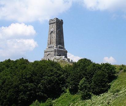
    Shipka MonumentStara-PlaninaStara Planina has a significant and special place in the history of Bulgaria since its foundation in 681. It was a natural fortress of Bulgarian Empire for centuries and formed an effective barrier to Moesia where most of the Medieval capitals were located. The Balkan Mountains were the site of numerous battles between Bulgarian and the Byzantine Empires including the Battle of the Rishki Pass in 759, Battle of the Varbitsa Pass in 811, Battle of Tryavna in 1190 and many others. In the battle of the Varbitsa Pass Khan Krum decisively defeated an enormous Byzantine army killing Emperor Nikephoros I. For many centuries the Byzantines feared that mountain and on several occasions Byzantine armies had pulled back only on the news of approaching Stara Planina.

    During the Ottoman rule many haiduks found refuge in Stara Planina. Close to the highest summit the Botev Peak is Kalofer the birth place of Hristo Botev, a Bulgarian poet and national hero who died in the Western Stara Planina near Vratsa in 1876 in the struggle against the Ottoman Empire. Also close to Botev peak is the Shipka Pass scene of four battles in Russo Turkish War, 1877-78 which ended Turkish rule in the Balkans. Close to the pass in the village of Shipka there is a Russian Orthodox Church built to commemorate Russian and Bulgarian bravery during pass defense.

Post Title

Balkan Mountains


Post URL

https://guidice-galleries.blogspot.com/2010/07/balkan-mountains.html?m=0


Visit guidice galleries for Daily Updated Wedding Dresses Collection

Peles Castle

    Peles Castle is a historical monument Neo-Renaissance castle placed in an idyllic setting in the Carpathian Mountains near Sinaia in Prahova County, Romania, on an existing medieval route linking Transylvania and Wallachia built between 1873 and 1914. The inauguration was held in 1883. It is also called as Castelul Peles in Romania. The details of Peles Castle are explained in world tour guides below.

    Peles CastleKing Carol I who is one of the great Romanian kings and conqueror of National Independence first visited the region and future site of castle in 1866. In 1872 one thousand pogoane which is approximately 1,300 acres was purchased by King and Piatra Arsa region becomes Royal Domain of Sinaia, destined to be a royal hunting preserve and summer retreat for monarch. On August 22, 1873 the foundation for Peles Castle city of Sinaia and certainly for country of Romania was established. Several other buildings are invaded to castle were built concurrently are Guards Chambers, Economat Building, Foisor Hunting Chateau, Royal Stables. The Power Plant was also constructed then, and Peles became worlds first castle fully operated by electric power.

    Peles Castle has 3200 sq. meters of floor plan, over 170 rooms, 30 bathrooms, many with dedicated themes from world, themes that can vary by function or by style are extremely lavishly furnished and decorated to the slightest detail. The establishment hosts one of the finest collections of art in East and Central Europe, consisting of statues, paintings, furniture, arms and armour, gold, silver, stained glass, ivory, fine china, tapestries and rugs. The collection of arms and armour has over 4000 pieces, divided between Eastern and Western war, ceremonial or hunting spreading over four centuries in history. Oriental rugs come from the finest sources Bukhara, Mosul, Isparta, Saruk and Smirna, porcelain from Sevres and Meissen, leather from Cordoba but perhaps the most acclaimed are the hand painted stained glass vitralios.

    A towering statue of King Carol I by Raffaello Romanelli overlooks the main entrance but many other statues are present on the seven Italian neo-Renaissance terrace gardens, mostly of Carrara marble executed by the Italian sculptor Romanelli. The gardens also host fountains, urns, stairways, guarding lions, marble paths and other decorative pieces. This has many different kinds all over the world, till today we still do not know. Peles Castle shelters one of the most important and most valuable painting collections in Europe almost 2,000 pieces. An interesting account about Peles Castle remains the one that comes from Angelo de Gubernatis an Italian writer who arrived in 1898 in Sinaia as a guest of the Royal Family.

    Inaugurated in 1883, Peles Castle is not only a pleasant place during summer time. It has been conceived to be also a national monument, meant to keep the trophies of the Plevna victory, which explains the simple but majestic style. The castles courtyard Bramantes type with a fountain in the middle, in the most accurate Renaissance style, pleasantly surprises the visitor. The courtyard has a merry decoration, made out of plants and flowers all round the buildings facades are animated by elegant drawings. The interior of the castle is a true wonder, due to the beauty and richness of the sculpted wood and the stained glass windows.

    There are 168 rooms in the castle only 35 are accessible to the public. While an important area is in the upper levels, this is off limits. Only the museum in the basement and the rooms on the first floor can be visited. The visiting hours are from 9 a.m. to 5 p.m Wednesday through Sunday. On Mondays the castle is closed and on Tuesdays the hours are till 11 a.m. to 5 p.m. These visiting hours are subject to change by the Romanian Culture Ministry. Each year in November the castle is closed to public for whole month, during which time it undergoes maintenance and cleaning. Admission fee is 20 RON for adults, 5 RON for school-age children. Additionally you must check your camera or pay 30 RON to take photos or 50 RON for video.

    The location of Peles Castle is northwest of the town of Sinaia, 60 km from Brasov and 135 km away from Bucharest which is Romania capital. Nested in the south-eastern Carpathian Mountains, the complex is composed of three monuments Peles Castle, Pelisor Chateau and Foisor Hunting Chateau. The notable Grand rooms are Honour Hall, Imperial Suite, Grand Armory or The Arsenal, Small Armory, Playhouse, Florentine Room, Moorish Salon and Turkish Parlor.

    Peles CastlePeles Castle

Post Title

Peles Castle


Post URL

https://guidice-galleries.blogspot.com/2010/07/peles-castle.html?m=0


Visit guidice galleries for Daily Updated Wedding Dresses Collection

Saint Sophia Cathedral

    Saint Sophia Cathedral in Kiev is an outstanding architectural monument of Kievan Rus. Today it is one of the cities best known landmarks and the first Ukrainian patrimony to be inscribed on the World Heritage List. In Ukrainian the cathedral is known as Sobor Sviatoyi Sofiyi or Sofiyskyi sobor. In Russian it is known as Sobor Svyatoi Sofii or Sofiyskiy sobor. The details of Saint Sophia Cathedral are explained in world tour guides below.

    Saint Sophia CathedralThe complex of the Cathedral is the main component the National Sanctuary Sophia of Kiev the state institution responsible for the preservation of the Cathedral complex along with several other historic landmarks of the city. The cathedrals name comes from the 6th-century Hagia Sophia cathedral in Constantinople meaning Holy Wisdom, and dedicated to the Holy Wisdom of God rather than a specific saint named Sophia. According to a less popular theory its model was 13-domed oaken Saint Sophia Cathedral in Novgorod which Yaroslav I the Wise determined to imitate in stone as a sign of gratitude to citizens of Novgorod who had helped him secure the Kievan throne in 1019.

    The first foundations were laid out in 1037, but the cathedral took two decades to complete. The structure has 5 naves, 5 apses and 13 cupolas. It is surrounded by two-tier galleries from three sides. Measuring 37 to 55 m, the exterior used to be faced with plinths. On the inside, it retains mosaics and frescos from the eleventh century, including a dilapidated representation of Yaroslavs family, and the Virgin Orans. Originally the cathedral was a burial place of the Kievan rulers including Vladimir Monomakh, Vsevolod Yaroslavich and of course the cathedral's founder Yaroslav I the Wise, although only the latter's grave survived to our days.

    After the pillaging of Kiev by Andrei Bogolyubsky of Vladimir Suzdal in 1169, followed by Mongolian Tatars in 1240, the cathedral fell into disrepair. Subsequently the 1595-96 Union of Brest, the cathedral of Saint Sophia belonged to the Ukrainian Greek Catholic Church until it was claimed by the Moldavian Orthodox metropolitan Peter Mogila in 1633. Mogila commissioned the repair work and the upper part of the building was thoroughly rebuilt, modeled by the Italian architect Octaviano Mancini in the distinct Ukrainian Baroque style while preserving the Byzantine interior, keeping its splendor intact. The work continued under the Cossack Hetman Ivan Mazepa, and in 1740 the Cathedral was completed to its present form.

    Saint Sophia CathedralSaint Sophia CathedralAfter the Russian Revolution of 1917 and during the Soviet antireligious campaign of the 1920s, the government plan called for the cathedral's destruction and transformation of the grounds into a park Heroes of Perekop after a Red Army victory in the Russian Civil War in Crimea. The cathedral was saved from destruction primarily with the effort of many scientists and historians. Nevertheless in 1934 Soviet authorities confiscated the structure from the church, including the surrounding seventeenth–eighteenth century architectural complex and designated it as an architectural and historical museum.

    Since the late 1980s Soviet, and later Ukrainian, politicians promised to return the building to the Orthodox Church. Due to various schisms and factions within the Church the return was postponed as all Orthodox and Greek Catholic Churches lay claim to it. Although all of Orthodox churches have been allowed to conduct services at different dates other times they are denied access. Most memorable was the funeral of Patriarch Volodymyr of Ukrainian Orthodox Church Kiev Patriarchy in 1995, when riot police were forced to prevent the burial on premises of museum and a bloody clash took place. The complex now remains a museum of Ukraine Christianity with most of its visitors being tourists. On 21 August 2007, the Saint Sophia Cathedral was named one of the Seven Wonders of Ukraine based on a voting by experts and the internet community.

Post Title

Saint Sophia Cathedral


Post URL

https://guidice-galleries.blogspot.com/2010/07/saint-sophia-cathedral.html?m=0


Visit guidice galleries for Daily Updated Wedding Dresses Collection

Popular Posts

My Blog List